
4 days and counting: Bicycling from Bar Harbor ME to Baltimore MD
Prepping for stage 1 (Bar Harbor Maine to Baltimore Maryland) of our cross-country (north to south) bicycle ride, I have had the opportunity to test drive everything from Adventure Cycling paper maps to electronic GPS devices searching for one piece of gear that would keep our bicycle rides on course.
Now, to be clear, my best bicycle rides are those where I get lost, face off with a little adventure (such out-sprinting a loose dog) and magically end up exactly where I needed to be. A quick peek at the sun, a few best guesses and a gut feel has worked quite well in navigating my bike and I back to some destination. The notion of actually ‘needing’ a route, planning a route and trying to follow a route goes against my organic ‘lets just let it evolve’ grain. But alas, we will be bicycle touring – with daily destinations, daily mileage goals and legs that will eventually run out of steam.
When I first received my copy of Adventure Cycling paper maps I was sure they had made a mistake. Tiny maps, with even smaller que sheets were somehow supposto be viewed by AARP eyes while riding a bicycle and avoiding traffic? C’mon now! It’s 2015 — the digital age is well entrenched – so how about GPS navigation similar to what is used in automobiles? As a technology geek, I had to find a technology solution.
But wait. GPS for bicycles cannot work like GPS for autos. When you hop in your car – you likely have a built in GPS system, or some type of GPS attachment, or maybe just your phone that guides you how to get from point A to point B. With bicycles – you don’t want the fastest route. Instead, you want to pre-define your route. You want to set your mileage. You want to check-in with your legs to see what kind of climbs are do-able. With that, finding GPS navigation that worked on bicycles became my mission.
At some point in this search – I test drove bike navigation software and hardware. Going from “planning” (selecting less traveled roads) to “operating” (a device) a programmed route to navigation, with audible and visible ques is where the challenge lies. My goal was to find a single device that could….
- provide turn by turn directions based on a planned route on less traveled roads (i.e. not optimized to get you there in the fastest amount of time)
- stay powered for up to 10 hours of riding
- can be protected from bad weather conditions
- can be viewed when the sun is shining or on cloudy days
- not bulky (doesn’t interfere with moving the handlebars or bump into my knees while riding)
- not heavy (still will need to out-sprint dogs!)
- can easily be removed from the bicycle when not in use
- limited amount of wiring / setup (we want to ride, not futz with electronics)
- device stays on even when you don’t touch the screen
- satellite operation — works when you are out of cell phone range or in remote areas
- inexpensive…or better yet uses something that I already have tucked away in a cardboard box
Unfortunately, there is always one missing link to my ideal navigation. One ‘problem’ that has yet to be solved. One bit of technology that that leaves you scratching your head.
I tried the Garmin Edge 1000 and all of it’s cousins that were touted as bicycle navigation computers. Many of the features work well, but the features that I needed were not ready for prime time. They were also expensive, and have the added challenge of needing reading glasses to read tiny screens. There were no audible ques, the bluetooth connection to my phone wasn’t stable, and my bike and I appeared as a small dot in a big field on country roads. Nope, these devices were returned for refunds.
Next I tried using our Garmin Nuvi’s with the programmed routes from RideWithGPS. The Nuvi is a device that once lived stuck to the windshield of my car. We found a way to attach the Nuvi to my bicycle, and could even power these using a battery pack, but they wouldn’t load .gpx files created from my route planner. In other words, I could see a map of where I am, but could not tell it to follow my bicycle route.
We tried using my running / bicycling watch- the Garmin Forerunner 910 – to see if we could download a route – but no. Ok, we didn’t really expect this to work, but why not try? The forerunner tracks where you have been, period.
Then, we tried using our smartphones. The advantage of smartphones is there are many APP choices that can be loaded – such as my routes designed through RideWithGPS.com. The disadvantage of smartphones, is they need a regular dose of ‘juice’, they need to be protected (you don’t want to trash your phone while riding your bike in the rain), and they need to be touch-accessible and viewable in bright sunlight. And of course – as soon as you are out of cell phone range – your smart phone has lost it’s ‘smarts’.
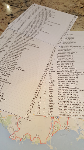
Exasperated with technology – I returned to staring at the Adeventure Cycling maps, and my own RideWithGPS routes and started printing que sheets. I wasn’t looking forward to using paper. While printing the que sheets, I noticed that some days of riding had ques (turn by turn directions) of 15 turns or less, and other days the number of turns were closer to 120. This will not work. There is no way my eyes & brain could keep track of 120 printed turns…. We had to keep trying to find a technology solution.

At the 11th hour, the B2B Team’s bike mechanic has pieced together a combined-navigation solution (i.e. no single device) – that will NOT rely on old school paper que navigation. It is a combination of electronic navigation gear we currently owned, tweaked with settings that are not always advisable unless you are bicycling, powered by a BRICK battery pack and 3 amazing lightweight waterproof pouches that somehow fit on the handlebars without turning the bicycle into a monster.
Since one single device could not provide the necessary navigation….why not use a combination? The final navigation solution uses:
- Garmin NUVI for real-time map viewing – not for navigation, and powered by Brick output #1
- Samsung Galaxy 6 phone for ridewithgps maps downloaded to the phone (minimize cell usage), and no phone security, set to longest display time before going dark – which means I just tap the screen for it to return to my maps and ques
- Dry bag pouch for the phone mounted on the bike stem
- Waterproof pouch to hold the Garmin Nuvi
- Handlebar bag w/foul weather cover with headlight on top, to hold the Brick mambo-jambo battery pack and wires
- And when wearing bike gloves with fingertips exposed — all screens can be accessed
My test rides have been successful. We can ride up to 11 hours on “Brick” power before needing to re-charge. Hopefully the east coast towns on our routes are stocked with electricity. Though, just to be sure we get from point A to point B, printed que sheets will be our backup plan 😉
