Every time we approach one of these 65′ fixed bridges, with our 63.5′ air draft, it appears we won’t clear…until inches before potential contact with the bridge. If only someone would take notes – so that we could have some feel as to whether the measuring stick is accurate, or the water levels are running high vs low….and general observations. Hey? Maybe that “someone” should be me? Below are my notes for all 13 fixed bridges between the mouth of the Cape Fear River (NC)….and Norfolk, VA.
Other tall masted sailboat may not have the same experiences we did — due to tidal fluctuations, the lunar cycle, and winds…so be sure to navigate carefully and wisely based on your own observations. Here is what we found:
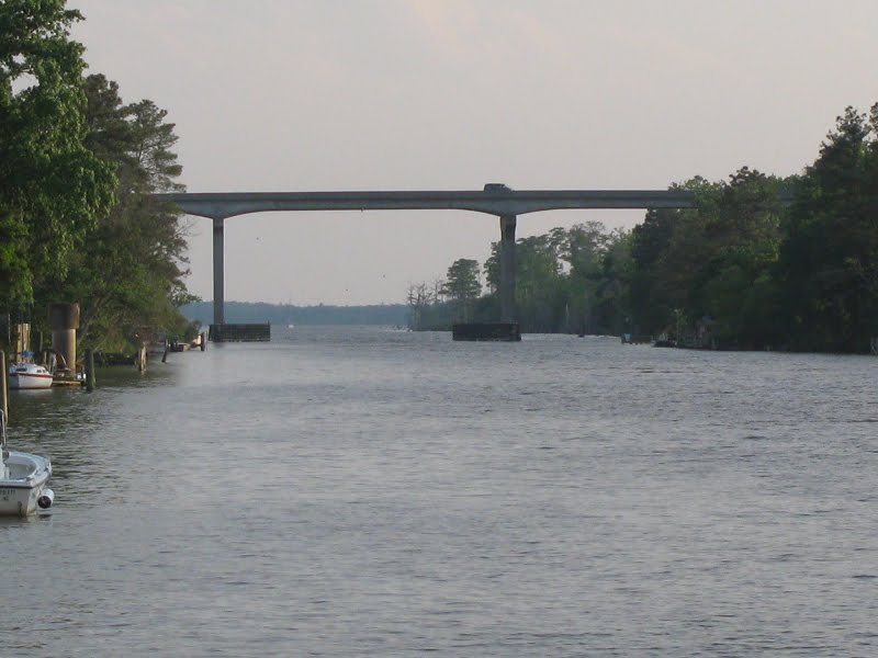
Note: Our VHF antenna is 2′ above our mast height of 63′ 7″ This would make clearance (without contact with VHF antenna) to be 65′ 7″.
Carolina Beach Highway Bridge (NC)
mile marker 295.7
does bridge have measuring stick? Yes
measuring stick reads: 68′
tidal timing: 2 hours after high tide (low high tide)
our experience: NO contact with our VHF antenna
winds: 15 knots southeast
accuracy of measuring stick: good
notes: we had plenty of clearance, even with weekend boaters creating wake
The following bridges are affected by ocean tides:
North Topsail Beach Route 210 Bridge (NC)
mile marker 252.4
does bridge have measuring stick? Yes
measuring stick reads: 67′
tidal timing: 2 hours after high tide (low high tide)
our experience: Ticked top of VHF antenna
winds: 15 knots southwest
accuracy of measuring stick: probably high…estimate closer to 65.5
notes: we had plenty of clearance
Emerald Isle Highway Bridge (NC)
mile marker 225.7
does bridge have measuring stick? Yes
measuring stick reads: 65.5′
tidal timing: 1 hour before low tide (low low tide)
our experience: Ticked top of VHF antenna
winds: 10 knots southwest
accuracy of measuring stick: good
notes: we had plenty of clearance
Atlantic Beach Highway Bridge (NC)
mile marker 206.7
does bridge have measuring stick? Yes
measuring stick reads: 66′
tidal timing: 1 hour after low tide (low low tide)
our experience: NO contact with our VHF antenna
winds: 15 knots southeast
accuracy of measuring stick: good
notes: we had plenty of clearance
US Route 70 Highway Bridge (NC)
mile marker 203.9
does bridge have measuring stick? Yes
measuring stick reads: 66′
tidal timing: 1.5 hours after low tide (low low tide)
our experience: NO contact with our VHF antenna
winds: 15 knots southeast
accuracy of measuring stick: good
notes: we had plenty of clearance
Core Creek Highway Bridge (NC)
mile marker 195.9
does bridge have measuring stick? Yes
measuring stick reads: 67′
tidal timing: 3 hours after low tide (low low tide)
our experience: NO contact with our VHF antenna
winds: 15 knots southeast
accuracy of measuring stick: good
notes: we had plenty of clearance
The following bridges are affected by wind tides:
Hobucken Highway Bridge (NC)
mile marker 157.2
does bridge have measuring stick? No
measuring stick reads: I got a Stanley electronic measurement from the bow of 60′ 11′. Add this to our bow height of 3′ 10″ off the water – and this bridge measures 64′ 9″ .
tidal timing: —
our experience: Ticked our VHF antenna
winds: 10 knots southeast
accuracy of measuring stick: —
notes: we had plenty of clearance
Wilkerson Highway Bridge (NC)
mile marker 125.8
does bridge have measuring stick? YES
measuring stick reads: 65′
tidal timing: —
our experience: Ticked our VHF antenna
winds: 10 knots southeast
accuracy of measuring stick: good
notes: we had plenty of clearance
Fairfield Highway Bridge (NC)
mile marker 114
does bridge have measuring stick? NO
measuring stick reads: —
tidal timing: —
our experience: lightly ticked our VHF antenna
winds: 10 knots southeast
accuracy of measuring stick: -no measure, but best guss is 65′ 5″
notes: we had plenty of clearance
Coinjock Highway Bridge (NC)
mile marker 50.1
does bridge have measuring stick? YES
measuring stick reads: 64.5 from southbound entrance, no mark on NB entrance
tidal timing: —
our experience: ticked & slightly dragged our VHF antenna
winds: 10 knots southeast
accuracy of measuring stick: -fair
notes: much tighter clearance than we expected
Route 726 Highway Bridge (NC)
mile marker 28.6
does bridge have measuring stick? YES
measuring stick reads: 64.5
tidal timing: —
our experience: ticked and dragged at 90 degrees our VHF antenna
winds: 20 knots northeast
accuracy of measuring stick: -probably reads higher than actual clearance
notes: we barely cleared this bridge
Great Bridge Highway Bridge (VA)
mile marker 12.6
does bridge have measuring stick? NO
measuring stick reads: —
tidal timing: —
our experience: lightly ticked our VHF antenna
winds: 20 knots northeast
accuracy of measuring stick: -no measure, but best guss is 65′ 5″
notes: we had plenty of clearance
The following bridges are affected by ocean tides:
Route 64 Highway Bridge (VA)
mile marker 7.1
does bridge have measuring stick? NO (bridge appears to be a bascule bridge, but it does not open!)
measuring stick reads: —
tidal timing: 2 hours before low tide
our experience: no contact with our VHF antenna
winds: 20 knots northeast
accuracy of measuring stick: -no measure, but best guss is 66′
notes: we had plenty of clearance
