
Notes from dockside:
Friday, Oct 16, 2009 9AM:
On an unusually COLD (40 degree) and drenching rain day in Baltimore, Cat Maudy departs the docks at Anchorage Marina…to head south to Charleston SC. Captain Pat heads up a very capable 4 man crew of John Martin and Frank Rubright from Michigan, and Bill Edwards from Baltimore MD. Finding the right weather window, along with crew availablity is not always easy. With unusually cold and downpour rains, accompanied by gale force winds – this would not be a weather window where I would leave the dock. But alas, I am not on this leg of the southern trip, and the decision is made by the Captain and crew.
On an unusually COLD (40 degree) and drenching rain day in Baltimore, Cat Maudy departs the docks at Anchorage Marina…to head south to Charleston SC. Captain Pat heads up a very capable 4 man crew of John Martin and Frank Rubright from Michigan, and Bill Edwards from Baltimore MD. Finding the right weather window, along with crew availablity is not always easy. With unusually cold and downpour rains, accompanied by gale force winds – this would not be a weather window where I would leave the dock. But alas, I am not on this leg of the southern trip, and the decision is made by the Captain and crew.
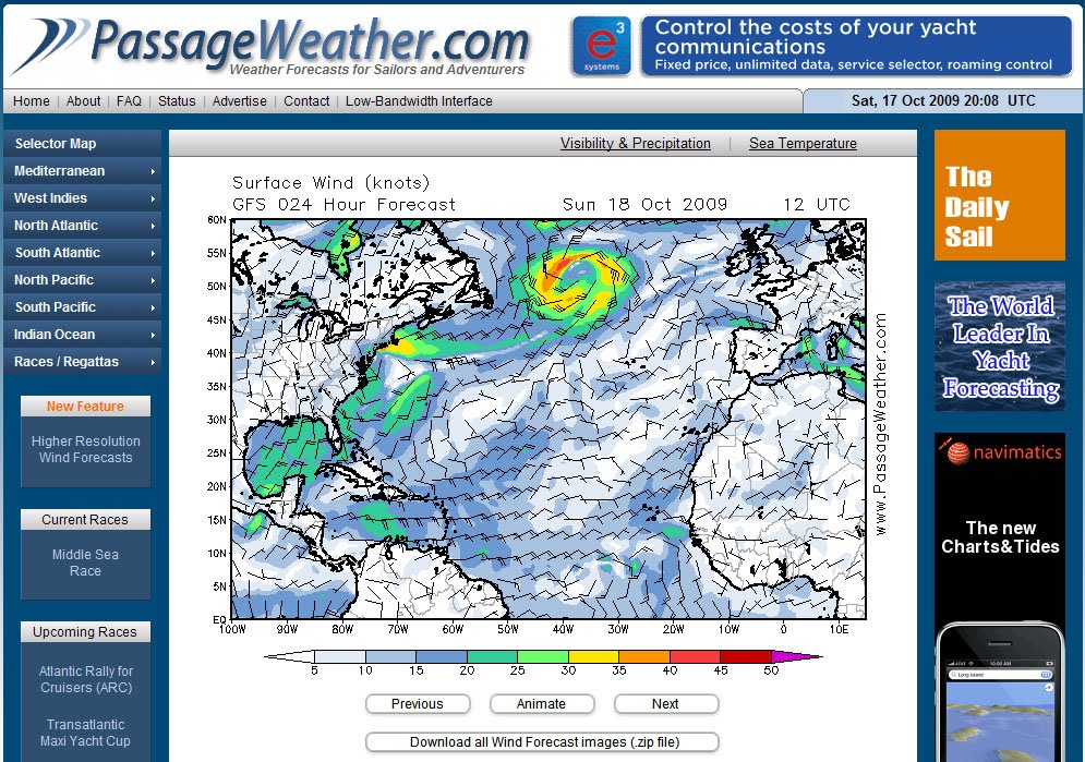
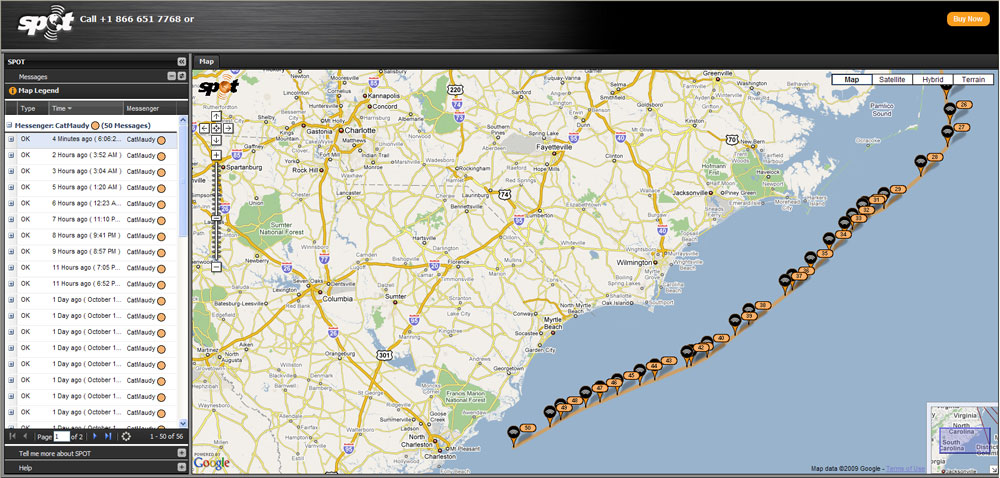
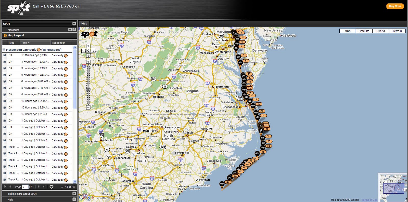
Thanks to SPOT – those of us at dockside have complete visibility to GPS positions of Cat Maudy while at sea….and thanks to NOAA weather buoys – the actual wave height, winds and sea state conditions are readily available. Sometimes, this is too much information. The buoy’s indicate the sea state conditions at the mouth of the Chesapeake Bay. And, the conditions are deterioriating rapidly. It is now 4AM, and I can no longer watch.
 Saturday, Oct 17, 2009 6:30AM:
The good news, is that the air temperatures are in the 50’s. The bad news is that the winds are blowing 25-30, and it feels like temps are in the 30’s. Pat calls from cell phone range to report in. He sounds exhausted – but not as bad as he sounded yesterday. Once out of the mouth of the Chesapeake Bay – there is no turning back. There are no harbors or ports to sail into – until you reach the southern portion of the outer banks – at Beaufort, NC. Each time a new SPOT position was transmitted by Cat Maudy – I ran all of the speed and weather checks, to evaluate how they were doing. The weather checklist includes:
Cape henry data buoy: For sea state off mouth of the ChesapeakeChesapeake lt off Chesapeake bay entrance: For near shore wind conditions
Sunday, October 18, 2009 9:15AM
Pat calls from the satellite phone. They are double reefed on the main, and have a reefed jib…and are cruising along at 9 knots.
Monday, October 19, 2009 9AM
Cat Maudy and crew approach the entrance to the Charleston harbor…
